Aerospace · Research and development
Our satellites fly with the wind.
High-altitude balloons carry our electronics up to 38 km and across whole continents in days, for a fraction of the cost of a satellite. We develop trackers, radio, cameras and ground stations ourselves.
Satellites on a budget
A high-altitude balloon is a satellite that costs little and gets quickly to where it is needed.
It launches in hours instead of years, rides the high-altitude winds across countries and oceans and collects data where no other technology reaches. Everything it measures and sees reaches the ground by radio only.
We bring this experience into client projects: low-power electronics, sensors, radio and software that receives and evaluates data reliably. Hardware and controls →
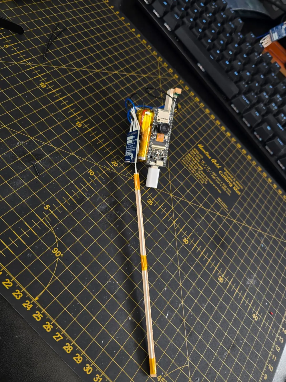

AURA at 38 km
Images from the stratosphere, by radio to the ground.
Built for up there
This is what we are proud of: electronics that manage entirely on their own up there. Every flight is a stress test we cannot repeat.
Cold
The electronics start up and transmit at temperatures far below zero.
Thin air
Hardly any cooling, big differences between sun and shade. Every component has to cope.
Unfiltered sun
Above the clouds, radiation hits housings, cables and boards at full strength.
Power from above
The WSPR trackers live on solar power, day after day, for weeks.
Every gram counts
Whatever is not essential stays on the ground. Light and still sturdy, that is the real craft.
No second attempt
After launch nobody can step in. Every solder joint, every antenna and every line of firmware has to be right beforehand.
Two systems of our own
Shortwave via the ionosphere
WSPR tracker
A Raspberry Pi Pico (RP2040) with GPS and a temperature sensor, powered by solar cells. It transmits a few milliwatts on shortwave, in the 20 and 10 metre bands.
The signals are reflected back to earth by the ionosphere, several hundred kilometres up, and skip across thousands of kilometres. Receiving stations around the world report what they hear: the balloon's position, altitude and temperature.
The trackers ride the high-altitude winds at 10 to 12 km, for weeks and across continents.
- RP2040
- pico-WSPRer
- GPS ATGM336H
- DS18B20
- 20 m and 10 m
- Solar
Atmospheric Upper Altitude Recon Asset
AURA
Our camera system for high altitude. A camera takes pictures, a LoRa radio module sends them to the ground station on 433 MHz, and GPS provides the position.
We develop the software for payload, ground station and analysis on the PC ourselves. The highest flight so far reached 38 km, well into the stratosphere.
- OV5640
- LoRa RFM96W
- 433 MHz
- GPS
- CircuitPython
Arctic project
Next, we are taking a probe to the North Pole by balloon.
There it is set down and keeps transmitting: readings from the permanent ice, carried thousands of kilometres home via the ionosphere. For us it is the next stress test for electronics, power and radio, under conditions that could hardly be harsher.
- DestinationNorth Pole
- TransportHigh-altitude balloon
- On arrivalProbe is set down
- Datavia shortwave and the ionosphere
- PurposeTest under extreme conditions
What this technology can be used for
What we develop for our balloons can be used for many tasks on the ground and in the air.
Data from the atmosphere
Capture temperature, pressure, humidity and other readings where no fixed station exists. For research, weather and climate projects.
Receiving wildlife transmitters
A balloon at high altitude hears far. It can pick up the signals of transmitters on wild animals over large areas and pass them on, even where there is no receiving station on the ground.
Sensors without mobile coverage
LoRa transmits readings over kilometres with very little power. For places without mobile coverage: water levels, huts, construction sites and installations in the Alps.
Developing and testing radio
Test antennas, range and transmission methods under real conditions, from LoRa to shortwave.
Images from the stratosphere
Footage from up to 38 km altitude for research, education, media and advertising.
Components under extreme conditions
Test electronics and materials in cold and low pressure, under conditions close to space.
Security and defence
The same technology is of interest to emergency services, authorities and armed forces: links where there are none, and an eye on signals that cannot be trusted.
Radio relay at altitude
From high altitude the line of sight reaches hundreds of kilometres. As a flying repeater, a balloon can extend radio links across mountains and valleys, where no connection is possible on the ground.
Detecting GPS interference
GPS receivers at altitude as a sensor network: detecting and reporting interference and forged satellite signals, so-called spoofing, across large areas.
Ready in hours
No launch pad and no satellite contract. A balloon is in the air within hours, for situations where speed matters.
Details are discussed in person only.
Milestones
- Achieved
AURA at 38 km
Images from the stratosphere, transmitted by radio to the ground station.
- In progress
Around the world
The first circumnavigation by one of our own WSPR trackers is underway, received by stations around the globe.
- Next
Arctic project
A probe, carried to the North Pole by balloon and set down there, that keeps transmitting from the ice.
- Goal
A global network
Many of our own transmitters in the air at the same time, and solid ground infrastructure that receives their data reliably.